Overview
The MOTOTRBO integrated GPS allows for indication of subscribers’ location and routes on map.
TRBOnet gives rich functionality for GPS Positioning and supports various vector and raster map types.
Supported Maps
TRBOnet software supports the vector and raster maps:
Viewing subscriber routes
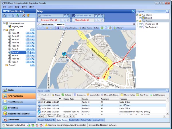
All the data for subscribers' location is stored in the database. A dispatcher can view the route of a selected
subscriber for a given time period.
A dispatcher only needs to click Show Route on the toolbar and specify subscriber and time period to display
the route for. A dispatcher can also set options like a custom color for the route and grouping the nearest
points while drawing the route.
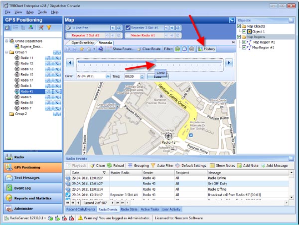
Location History
TRBOnet Enterprise software also allows a dispatcher viewing location history on the map. This feature is
really useful in case you need to know location of subscribers at a given time. To open or close History
mode just click History on the toolbar.
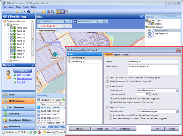
Geofensing and Speed Policy
The Geofencing function lets the dispatcher limit the movement of subscribers. The dispatcher can add regions on the map and make rules for entering or leaving a region.
For example, when a subscriber leaves a region, the system sends him/her a message and generates an alarm signal for the dispatcher.
TRBOnet allows adding several rules at once. For instance, you can have different rules for entering region 1, leaving region 1, entering region 2, speed limitation policy in region 3, etc.
You can also use speed policy to notify subscribers in case they exceed allowed speed
Maps in separate windows
TRBOnet supports various types of raster and vector maps. Different types of maps can be opened in separate windows.
This mode of GPS positioning is usually used in large dispatch centers with several monitors.
The dispatcher can open different maps and voice interface in different windows displayed on several monitors.
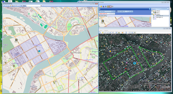
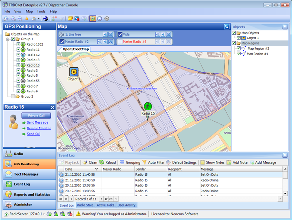
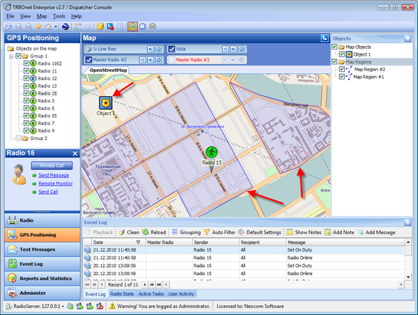
Custom objects and regions on the map
In order to use control points and control subscribers' location you can add your custom objects and regions on the map.
Custom regions can be really helpful to control subscribers entering or leaving exact area on the map.
A dispatcher can configure rules for subscribers and get notified in case a subscriber left or entered the region specified in the rule or exceeded allowed speed in the region.
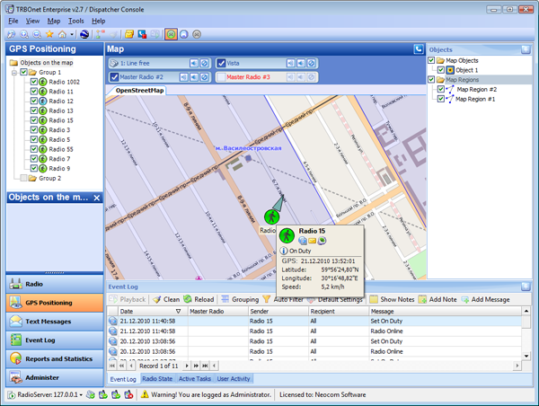
Direction and speed displayed on the map
The location data only is not enough for precise real-time monitoring of radio subscribers. Dispatchers also need subscriber's speed and direction in addition to location data.
TRBOnet software provides this functionality as well. Additional GPS data like subscriber's direction and speed can be also displayed on the map.
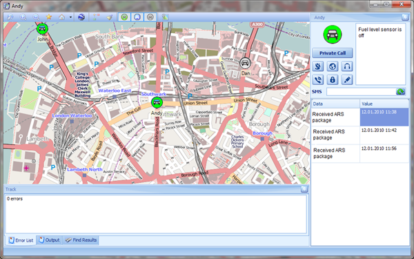
Monitoring an exact subscriber vehicle
A dispatcher might need to monitor an exact subscriber vehicle, its location, data received from this subscriber.
TRBOnet software allows the dispatcher monitoring an exact subscriber vehicle on the map. You can also send text messages make private calls or perform other actions with the monitored subscriber with one click.
Special interface is designed to monitor the state of vehicle's mobile radio telemetry sensors (e.g. doors opened/locked, engine started etc.)